
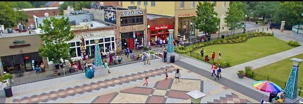
The “10-minute neighborhood” is a foundational urban planning concept embedded in the city of Decatur’s Destination 2030 Comprehensive Plan Update. The core objective is to ensure that every resident can safely access their daily needs—including grocery stores, parks, transit, and schools—within a 10-minute walk, bike ride, or transit trip without relying on a car, according to Decaturish.
City commissioners and planning consultants at TSW are actively updating land-use maps to institutionalize this strategy.
Core Strategies of the 10-Minute Framework
- Expanding Commercial Nodes: Replicating successful hubs like Oakhurst Village across other sectors of the city to decentralize retail and dining options.
- Bridging Retail Gaps: Prioritizing “destination retail” within the city limits so residents don’t have to drive outside Decatur for basic needs like clothing and hardware. A grocery store development on Commerce Drive is a major step in this initiative.
- Multimodal Infrastructure: Upgrading the city’s network of sidewalks, bike paths, and traffic calming measures—such as the Street Smarts: North Decatur Road Initiative—to make non-vehicular travel safe for all ages and abilities.
Infrastructure Zones (The Half-Mile Walkshed)
Local real estate insights from firms like the Golley Realty Group break down Decatur’s current walkability into defined zones based on distance from central hubs:
| Distance Zone | Walking Time | Typical Amenities Reached |
|---|---|---|
| 0 to 0.25 mile | Under 5 minutes | Immediate access to Decatur Square shops and the MARTA station. |
| 0.25 to 0.5 mile | 5 to 12 minutes | The core “walkshed,” encompassing downtown blocks and neighborhood parks. |
| 0.5 to 1.2 miles | 12 to 25 minutes | Edge-of-downtown streets; walkable but shifting toward biking or transit territory. |
Parks and Greenspace Equity
Decatur has already achieved significant benchmarks regarding park access. According to the City of Decatur Greenspace Planning data, 97% of residents currently live within a 10-minute walk of a park or green space, drastically outperforming the national average of 54%. Major spatial anchors like the 77-acre Decatur Legacy Park serve as structural pillars for this green network. Community youth groups have even proposed leveraging this 10-minute park proximity to establish a localized, neighborhood-zoned residential composting system.
A Potential Blueprint For Other Cities–Like East Point?
Perhaps East Point could explore the 10-minute neighborhood concept, and the city is already taking steps toward the foundational infrastructure to make it possible. While Decatur relies on highly compact, historical density, East Point has the distinct advantage of a major MARTA transit station anchored right in its historic downtown, giving it an immediate edge for Transit-Oriented Development (TOD).
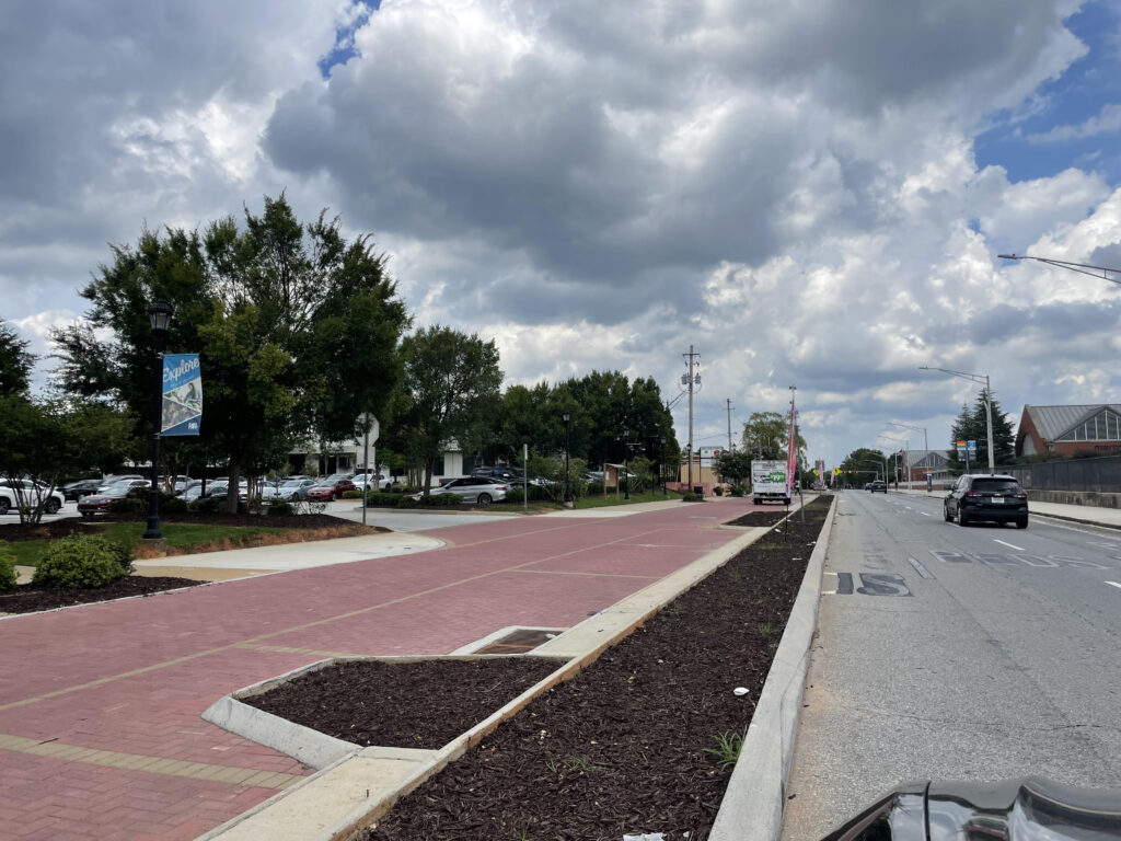
According to community surveys from the 2024 East Point Forward planning initiative and their Housing Assessment Draft, over half of participating residents specifically demanded walkable neighborhoods, a mix of commercial and residential uses, and direct connections to trail networks.
How Current Ideas Could Intersect:
The East Point PATH Master Plan: Partnering with developers, the city looks to convert underutilized public rights-of-way into a multi-use linear park and trail network. This will safely connect East Point’s surrounding neighborhoods directly to the downtown core for cyclists and pedestrians
East Point vs. Decatur: The Urban Planning Hurdles
While the blueprint is there, urban planning assessments note that East Point faces a different set of baseline challenges than Decatur:
| Challenge | East Point’s Status | Decatur’s Status |
|---|---|---|
| Commercial Continuity | Downtown suffers from sparse development, deep building setbacks, and excessive surface parking. | Tight, 15-block contiguous sidewalk network with storefronts kissing the sidewalk. |
| Industrial Barriers | Central corridors are fractured by heavy industrial zoning and vacant manufacturing sites. | Historically transitioned away from industrial use to prioritize commercial/residential zoning. |
| Retail Decentralization | Main shopping (e.g., Camp Creek Marketplace) is a car-centric, highway-adjacent strip mall miles from downtown. | Neighborhood-scale grocery and retail nodes are integrated directly into residential quadrants. |
The Roadmap: How East Point Could Try To Make it Work
To fully realize 10-minute neighborhoods, urban planners suggest East Point must aggressively utilize its Main Street Corridor TOD Plan to rezone older industrial properties into mixed-use spaces. This will bridge the visual and physical gaps between the MARTA station and residential areas, creating an uninterrupted building edge that feels safe and natural for residents to walk
Check This Out...
-
Happening Tonight: East Point City Council Meeting
-
City Of East Point To Host Dog Party Sunday, October 25: City Themes Event As “Howl-O-Ween Pawty”
-
75 Year Old East Point Grandmother Who Was Shot While Passing Out Food Tells WSB-TV She Can’t Walk, Was In Rehab For Months; Yearns To Pass Out Food Again: “I Miss It Every Time I’m Supposed To Go Out”
-
East Point Water Department Wins Georgia Water Association Award (GAWP) For Third Consecutive Year
-
Early In-Person Voting Begins Today October 13